Earth Observatorium: Earth Image Atlas
1999
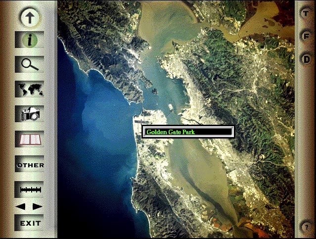
Since I had already done the CDROMS, STS59/68 which featured many low (screen size) resolution images of Earth from space, I wanted to show Earth in more detail. I selected about 80 images from NASA's Best of the Shuttle collection and used them to show off our planet. I was hoping that it would help people appreciate the beauty of our Earth and thereby develop a better sense of respect of the environment. I also wanted to provide a great resource for geography teachers for identifying important physical features of the Earth from space. As you move the cursor over a high-res image, the program pops-up the name of individual features.
The program was written in Director with extensive use of Lingo for indexing and buffering images. By far the most time consuming effort in the almost two year self-funded project was the identification of the over 5,000 physical features in the images. I purchased maps from all over the world to do this (and probably still got some features placed wrong.) It also features still photos of important items in the pictures (from a ground perspective), descriptive text, and search capabilities. I composed the introductory music (with some help from my brother John). I think it was my best effort to date. Unfortunately, I ran out of both energy and money to try to distribute and sell it. I still have a lot of copies.
Some screen shots from CD-ROM.
<--Back
Additional Photos from Earth Image Atlas: (brought up in separate browser windows)
| Close Up Of Golden Gate (click magnifying glass) |
| Information Panel (i) for each image |
| From Library of Articles |
| Country by Country comparisions |
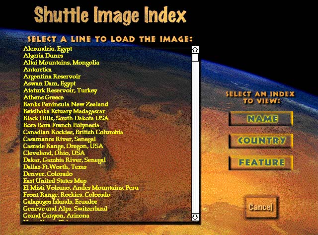
| Indexes for accessing photos (one of many) |
BACK to Portfolio Index of James "Newt" Perdue
Screen image Copyright, Rocky Mountain Digital Peeks CDROMs