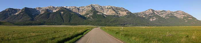

Weather plays a large part in creating the valley and mountains that we see today. Snow, rain, and wind are large factors in the continued erosion, creating deeper mountain canyons, new creeks, wider rivers, filled-in lakes and determining the type of vegetation and animals that can exist here.
The expansive system of shallow lakes, fens, carrs, serpentine river channels,
potholes, marshes, cold mountain streams, riparian shrublands, wet grasslands and warm springs that covers so much of the Centennial Valley floor gives clue to how the mountains continue to erode from weather and movement of water.
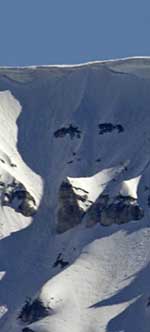
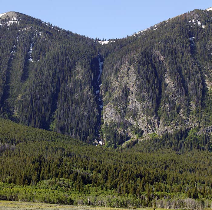
Many snow and rain fed springs and streams emanate from the Centennial Mountains and steepen the areas between the glacially eroded mountain peaks by loosening rock, and washing gravel and sedimentation to the valley floor. Large pyramidal shaped alluvial fans ![]() at the base of most of these steep canyons of the valley further attest to the continued erosion of these mountains. Many of the fans were formed when the glaciers melted 10,000 years ago and created large floods, but these fans continue to build from mountain streams. Occasional avalanches contribute to the erosion of the mountain faces here as evidenced by the several
avalanche chutes visible along South Centennial Road.
at the base of most of these steep canyons of the valley further attest to the continued erosion of these mountains. Many of the fans were formed when the glaciers melted 10,000 years ago and created large floods, but these fans continue to build from mountain streams. Occasional avalanches contribute to the erosion of the mountain faces here as evidenced by the several
avalanche chutes visible along South Centennial Road. ![]()
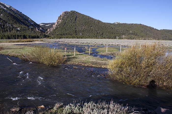
Rivers and streams also helped shape the Centennial Valley. The Red Rock River ![]() originally drained to the northeast into Madison Valley through a series of lakes that begins at Elk Lake and proceeds to the northeast to the Madison Valley.
originally drained to the northeast into Madison Valley through a series of lakes that begins at Elk Lake and proceeds to the northeast to the Madison Valley.![]() About 28,000 years ago, this drainage pattern changed as landslides created a large Pleistocene Lake Centennial, in the east Centennial Valley. This filled to over 60 feet higher than the current lakes until it spilled over a natural outlet near the current location of the Lima Dam.
About 28,000 years ago, this drainage pattern changed as landslides created a large Pleistocene Lake Centennial, in the east Centennial Valley. This filled to over 60 feet higher than the current lakes until it spilled over a natural outlet near the current location of the Lima Dam. ![]() The current lakes are mere vestiges of the original lake.
The current lakes are mere vestiges of the original lake.
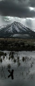
Prevailing weather systems here come from the south and southwest. The east-west trending nature of the Centennial Mountains cause the air masses to rise as these storms hit the back side of the mountains and creates a rain shadow effect and a high desert environment in the Centennial Valley. The Centennial Valley is distinguished by extensive sagebrush (Artemisia ) communities as evidence of this high desert environment. Even with this, the average annual rainfall is close to 22 inches, double some of the other mountain valleys in Montana. The nature of the geography here allows cool air to pool and keeps the valley quite cold, esp. in winter. Winter snows last well into May providing summer moisture to the many plants and animals. Over 150 inches of snow can accumulate on the top of the mountains here before spring thaw. Afternoon thundershowers are typical in the summer months, keeping the streams flowing and the grasses green through most of the summer months. Erosion is year round.
In some years of excessive rain or snow, or early warming, excessive snow melt causes creeks to overflow. (See this example in 2011 of Hell-roaring Creek overflow). These sometimes create new paths for the creeks and accelerate the erosion of the valley and mountain watershed areas. Human intervention in the valley has tended to limit the creation of multiple creek paths due to the creation of roads, drainage pipes, and ditches that constrain the water flow to a specific path.
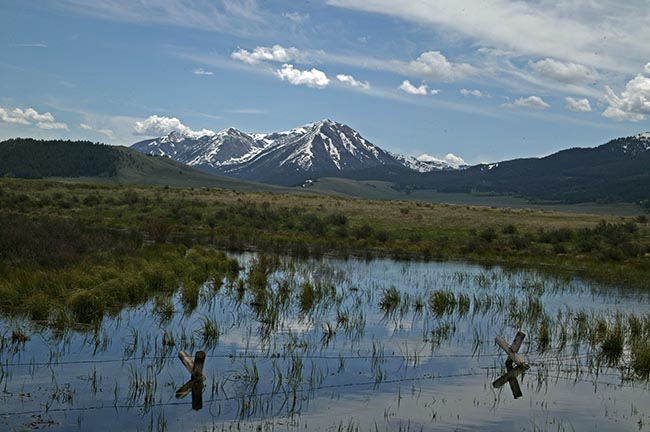
Snow melt on the valley floor during May and early June can keep a large portion of the Refuge wet or under water. This contributes to unique grasses and plants and provides habitat for water fowl, moose and other mammals late into the spring and early summer.
Throughout the past few thousand years, as the lakes have waned in size due to various factors, winds from the south have pushed sand from dry lake bottoms and dry creeks up along the northern hills to create many sand dunes.
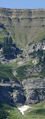
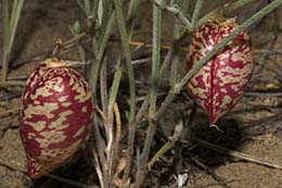
These sand dunes contribute to the geologic and ecological uniqueness of the Centennal Valley. The North Valley Road travels through several areas that are fine sand.![]() Most of the dunes are now covered with sagebrush and grasses and aren't readily identified as sand dunes. However, below this vegetation is sand. Rare plants thrive in this unique ecosystem such as the
Painted Milkvetch.
Most of the dunes are now covered with sagebrush and grasses and aren't readily identified as sand dunes. However, below this vegetation is sand. Rare plants thrive in this unique ecosystem such as the
Painted Milkvetch.
Another cause of mountain erosion is gravitational. Rocks, and debris are constantly being brought DOWN by gravity, often lubricated by rains, earthquakes, and wind. Sometimes large boulders will crash hundreds of feet into the valley. In the extreme, landslides make large changes to the face of the mountains. These can occur when underwater streams loosen the base of the soil on a steep mountain slope.