Other Links  
Sheep and Taylor Mountains
Ancient Oceans

Credits:

Thanks to Google Inc, for use of their Google Earth database and software.

Thanks to Falene Petrik for use of her extensive work on the Centennial Fault.

Thanks to Professor Kenneth Pierce of the USGS for use of his life's work on the Yellowstone Hotspot and lecture notes.

Thanks to WikiPedia for use of their extensive informational database contributed by experts around the world.

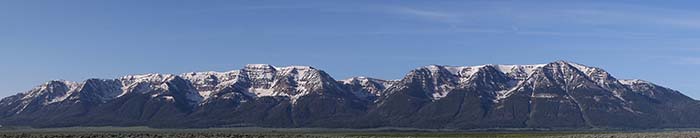
This Geology website was conceived, researched, and created by James "Newt" Perdue as part of his volunteer duties for the US Fish and Wildlife Service at the Red Rock Lakes National Wildlife Refuge.

Links to other web sites that are NOT part of the Fish and Wildlife Service about the geology of the Centennial Mountains, the greater Yellowstone area or other related subjects.

Scarp analysis of the Centennial Normal Fault, Beaverhead County, Montana and Fremont County, Idaho by Petrik, Falene Elizabeth (permission to quote and reuse graphics granted by the author)

Professor Kenneth Pierce, USGS Glaciation in the Rocky Mountains, by Ken Pierce

Mumma, S. A., Whitlock, Cathy, Pierce, Kenneth. 2012. A 28,000 year history of vegetation and climate from Lower Red Rock Lake, Centennial Valley, southwestern Montana, USAM: Palaeogeography, Palaeoclimatology, Palaeoecology, v. 326-328, p. 30-41.

Pierce, K.L. and L.A. Morgan. 2009. Is the track of the Yellowstone hotspot driven by a deep mantle plume? — Review of volcanism, faulting, and uplift in light of new data. Journal of Volcanology and Geothermal Research. 188:1-25.

Pierce, K.L., and Morgan, L.A. 1992. The track of the Yellowstone hot spot--volcanism, faulting and uplift (PDF 14.6mb). in Link, P.K., Kuntz, M.A., and Platt, L.W., eds., Regional geology of eastern Idaho and western Wyoming: Geological Society of America Memoir 179 p. 1-53, 24 figs., 1 color map.

This report documents the progression of the three processes of volcanism, faulting, and uplift that define the Yellowstone the hotspot track, and a mantle plume explanation most compatible with the surface geologic history.

Hotspot Map (PDF 10.4MB, printable at 11x17")

An Environmental Review of the Centennial Valley, Montana Joseph M. Trudeau December, 2007 PDF file download

Information in this website may be copyrighted and use thereof restricted by authors of the information. Please contact the appropriate authors for permission to reprint any copyrighted information in this website. Most photos are copyrighted by James "Newt" Perdue but may be reused for non-profit usage without permission. Attribution would be appreciated.


The Centennial Valley contains the largest wetland complex in the Greater Yellowstone Ecosystem. Many streams flow from the northern slope of the Centennials mountains and the southern slopes of the Gravelly Range and others are from spring fed locations. Watersheds in these mountain ranges create the major year-round streams, including Tom Creek, Hell-roaring Creek, Odell Creek, and Long Creek. Some are spring fed like Elk Springs creek, Picnic Springs and many others. All of these flow into Upper or Lower Red Rock Lake or Red Rock Creek, which flows into Red Rock River, a tributary of the Beaverhead River, thence to the Big Hole River, the Jefferson River and eventually flows into the Missouri and Mississippi Rivers. The water system here is at the origin of the longest river system in North America and the fourth longest in the world, spanning over 3745 miles from Bower Springs (below Mount Jefferson in the Centennial Mountains) to the mouth of the Mississippi River.
The climate of greater southwestern Montana can be described as semi-arid and tending toward Continental with a strong winter-summer temperature contrast; however, the numerous mountain ranges generate local distinctions and peculiarities. For instance, the east-west orientation of the Centennial Mountain range positions it to intercept cells of moist air that originate in the Gulf of Mexico and “drift” northward in mid to late summer. These cells are the source of relatively predictable afternoon thundershowers that can be quite intense and can cause the mountain meadows to remain green long into the growing season. Average annual precipitation at Lakeview (6,700 ft) at the very base of the range is 21.2 inches -- quite high for a valley location (compare to Wisdom, Montana another valley location at 6,100 ft. elevation, which receives only 11.8 inches annually). Precipitation probably exceeds 50 inches near the crest of the Centennial Mountains. Precipitation is relatively evenly distributed throughout the year with the exception of a spring bulge in May and June, a period typically receiving a little less than 1/3 of the average annual precipitation. This precipitation bulge is typical for western Montana’s mountainous areas. Not uncommonly, snowfall occurs every month of the year and can accumulate by the end of winter to depths of 150 inches. The average July maximum temperature is 76°F; the warmest recorded summer day has never exceeded 94 degrees. The average January minimum is -1° F; the coldest day in December, January, and February can be lower than -40º F with an all-time record low of -49º F. The yearly mean temperature is only 35º F, the lowest among recording stations in Montana and lower even than Montana’s well-known cold spot, Wisdom (in the Big Hole Valley). Though frost can occur in every month, the frost-free season averages about 51 days, from mid-June to mid-August. These figures alone suggest that the valley is a very cold environment, as could be predicted from its high elevation. This is exacerbated by the narrowness of the valley, the high mountain ranges surrounding it, and hills of the Alaska Basin just to the east, which impede airflow. These factors cause deep ponding of cold air in the Valley and the persistence of snowpack well into spring months. The fact that subalpine forest extends nearly to the valley floor on the north flank of the Centennial Mountains reflects the relatively cold temperature regime of this valley as well as its high precipitation.