Click the image at left for a detailed panoramic version.
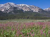
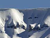
The Centennial Mountains rising above Red Rock Lakes National Wildlife Refuge display over 500 million years of geologic history. But that history had little to do with creating the mountains here.
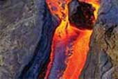
Volcanic action was responsible for creating the Centennial Mountains, yet you'll find no Volcanos or geysers in the Centennial Valley.
Glaciers shaped the Centennial Valley peaks but today you won't find a glacier anywhere here. The last ice age here was over 10,000 years ago and there's no prospect of another one in the foreseeable future.
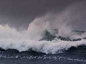
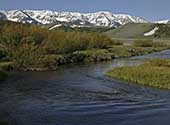
Today, the most active agent in shaping the mountains is the weather and its erosional effects. Small creeks, rivers, lakes, wind, rain and sunshine shape the Centennial Mountains and Valley today. Red Rock Creek is the major feature for the drainage of Centennial Valley.
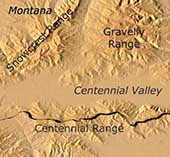
Using an interactive tool, explore the features of the Centennial Valley and surroundings using Google's Earth and Map database. Its fun and easy to use. Also, while visiting the other sections, click on the Google Earth Icon ![]() to see a specific feature on the map that is discussed in the text (you'll need Google Earth Plug-in for your browser.)
to see a specific feature on the map that is discussed in the text (you'll need Google Earth Plug-in for your browser.)
Refuge Geologic Slideshow
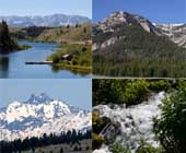
Enjoy viewing images of the Red Rock Lakes National Wildlife Refuge geology and surrounding area with our slideshow. Click HERE to view the slideshow.
Start The Geology Tour
Use the FEATURES pull-down menu above to start exploring more of the Red Rock Lakes National Wildlife geologic features and geologic history. Use the PHOTO GALLERY to view examples and explore specific features using the GOOGLE MAPS menu item. You can also click HERE to continue the tour.