Glacial activity has shaped the present Centennial Range over its entire existence. Just as much as volcanic action and earth movement has created or built up these mountains, glacial erosion and weathering has given them character and worn them down. Obviously, mountain building must outpace erosion or we wouldn't see the mountains that we have today. We are currently in an interglacial period without glaciers. The last Glacial Maximum was about 22,000 years ago, but only 10,000 years ago the Centennial Valley may have still had glaciers. In fact, there have been over 10 glacial periods during the building of the Centennial Mountains over 2 million years, each of them creating glaciers that helped to carve the peaks and canyons even deeper.
Glacial activity acts in several ways to shape the landscape. Glaciers build up on mountain slopes and in valleys from an accumulation of snow in winter that exceeds the rate of melting in spring and summer. Over many, many years of cold climate, they get larger and more dense and eventually get so heavy that they begin to move by gravity down the valley often following a creek bed. The continued snow continues to accumulate at the top of the glacier so in extended cold times, the glacier replenishes itself to make a
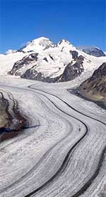
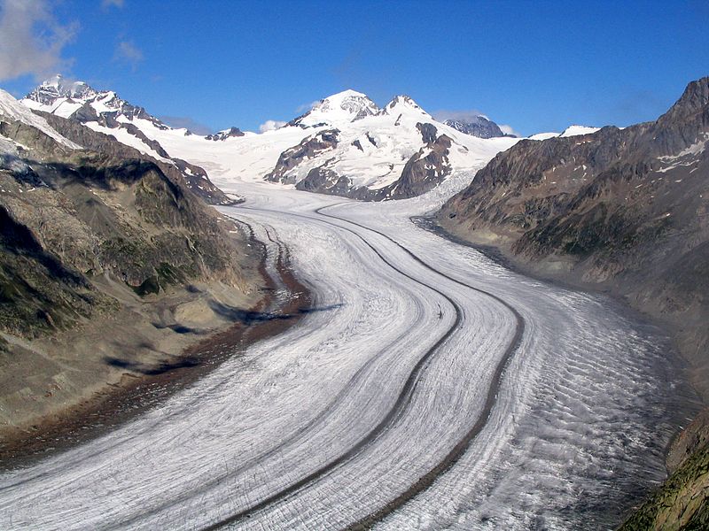
river of glacial ice (as this glacier in Switzerland). As it moves, this massive ice river or glacier plucks off rocks from the sides of the mountains, freezes rocks at the bottom which then travel with it creating abrasive bases digging the valley even deeper, and as it reaches a lower and warmer altitude it melts and deposits gravel, rocks and even large boulders (or erratics) making
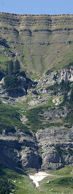
moraines and wide alluvial fans. Moraines can be created at the foot of a glacier or at the sides or both. These structures are often most identifiable as smoother hills with an assortment of rocks, gravel and boulders.
Several can be seen within the Centennial Valley as evidence of these glaciers.
![]()
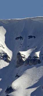
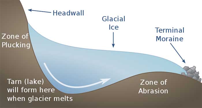
In the Centennial Valley, there are many glacier carved valleys. Some are U-shaped,![]() indicating a larger, longer and older glacier but many are more V shaped and narrow, indicating steeper, and shorter glaciers
indicating a larger, longer and older glacier but many are more V shaped and narrow, indicating steeper, and shorter glaciers![]() . Most have a cirque (see
diagram)
or ampitheatre shaped depression at the base of the steepest part of the peak face. The face of Taylor Mountain in the Centennial Valley has no fewer than 6 glacier valleys with cirques. There is one glacial valley between Sheep Mountain and Taylor that has 4 cirques, and Sheep Mountain has 4 cirques. East of Taylor Mountain there are numerous valleys that were once carved by Glaciers, probably the largest being that on the southwest face of Mount Jefferson, the highest point in the Centennial Mountains at 10,216 feet.
. Most have a cirque (see
diagram)
or ampitheatre shaped depression at the base of the steepest part of the peak face. The face of Taylor Mountain in the Centennial Valley has no fewer than 6 glacier valleys with cirques. There is one glacial valley between Sheep Mountain and Taylor that has 4 cirques, and Sheep Mountain has 4 cirques. East of Taylor Mountain there are numerous valleys that were once carved by Glaciers, probably the largest being that on the southwest face of Mount Jefferson, the highest point in the Centennial Mountains at 10,216 feet.
As the Glaciers melt, the melt water can carve deep rivers or creeks which change the landscape. Here, in the Centennial Valley, the glaciers contributed to building up the valley floor with debris and by creating lakes and creeks that made the valley fill with sediments.
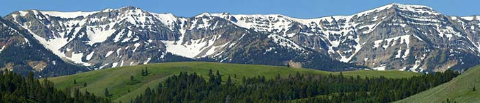
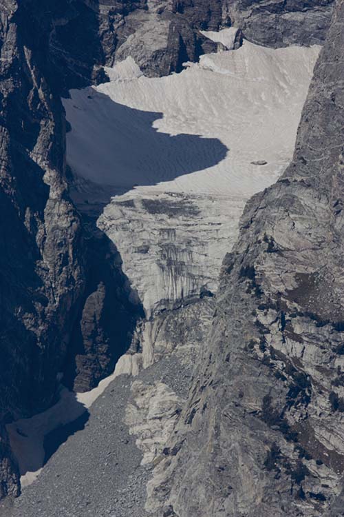
There are no longer any glaciers in the Centennial Valley, but some of the last remaining glaciers at this latitude are found not too far away in the Teton Mountain Range. The Teton Glacier is the largest but it is melting rapidly like most glaciers in the Northern Hemisphere today.
Since 1980, a significant global warming has led to glacier retreat in the Rocky Mountains and the rest of the world to become increasingly rapid and common, so much so that some glaciers have disappeared altogether, and the existence of a great number of the remaining glaciers of the world is threatened.
See examples of glacial geology in the Centennial Valley with our interactive Google Earth tool here.
Continue to the erosion section.